


Évaluations - 5, GPA: 4.2
(

 )
)
|
Photos et spécifications Sony HDR-CX360E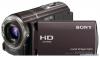 |


Par ce dispositif a également d'autres instructions :


Facilité d'utilisation
The GPS system consists of 24 or more GPS satellites. A GPS receiver compression coding technology, the picture may be disturbed in scenes where picture, field angles or brightness, etc. change drastically, but this is not a malfunction. Recording and playback on your camcorder Based on the AVCHD format, your camcorder records with the high definition image quality (HD). In addition to high definition image quality (HD), your camcorder is capable of recording a standard definition (STD) signal in the conventional MPEG-2 format. Video signal*: MPEG-4 AVC/H.264 1920 . 1080/50i, 1440 . 1080/50i, 1920 . 1080/25p (HDR-CX360E/CX360VE/PJ30E/ PJ30VE/PJ50E/PJ50VE) Audio signal: Dolby Digital 2ch/5.1ch Recording media: HDR-CX360E/CX360VE/PJ10E/PJ30E/ PJ30VE: Internal memory, memory card receives radio signals from the satellites, and calculates the current location of the receiver based on the orbital information (almanac data) and travel time of the signals, etc. Determining a location is called “triangulating.” A GPS receiver can determine the location’s latitude and longitude by receiving signals from 3 or more satellites. . As the positions of GPS satellites vary constantly, it may take longer to determine the location or the receiver may not be able to determine the location at all, depending on the location and time you use the camcorder. . “GPS” is a system for determining geographic location by triangulating radio signals from GPS satellites. Avoid using the camcorder in places where radio signals are blocked or reflected, such as a shadowy place surrounded by buildings or trees, etc. Use the camcorder in open sky environments. . You may not be able to record location information at locations or in situations where radio signals from the GPS satellites do not reach the camcorder as follows. GB 11 .In tunnels, indoors or under the shade of buildings. .Between tall buildings or at narrow streets surrounded by buildings. . In underground locations, locations surrounded by dense trees, under an elevated bridge, or in locations where magnetic fields are generated, such as near high voltage cables. . Near devices that generate radio signals of the same frequency band as the camcorder: near 1.5 GHz band mobile telephones, etc. On triangulating errors . If you move to another location right after turning the power switch to ON, it may take a longer time for the camcorder to start trianguating, compared to when you stay in the On the map data . The camcorder contains map data for the following countries/regions. Europe, Japan, North America, Oceania, etc. . Built-in map is powered by companies as follows; Map of Japan by Zenrin Co., Ltd., other areas by NAVTEQ. . The map data included is as of the date of production of this manual. . GPS maps will appear in 2-dimensional graphics except for certain landmarks in Japan, which will appear in 3D. . The map always displays the north at the top. . You cannot change the language on the map. . You cannot update the map data . The scale of the map is 25 m to 6,000 km. On the geographic coordinate system Table of Enjoy Useful Index (button) (button) (button) same place. . Error caused by the position of GPS satellites The camcorder automatically triangulates your current location when the camcorder receives radio signals from 3 or more GPS satellites. The triangulating error allowed by the GPS satellites is about 10 m (33 feet). Depending on the environment of the location, the triangulating error can be greater. In this case, your actual location may not match the location on the map based on the GPS information. Meanwhile, the GPS satellites are controlled by the United States Department of Defense, and the degree of accuracy may be changed intentionally. . Error during the triangulating process The camcorder acquires location information periodically during triangulating. There is a slight time difference between when the location information is acquired and when the location information is recorded on an image, therefore, the actual recording location may not match exactly the location on the map based on the GPS information. On the restriction of use of GPS . Use GPS in accordance with the regulations of the situation, the countries/regions of use. . The “WGS-84” geographic coordinate system is used. On copyright . The map data of the camcorder is copyrighted. Unauthorized copying or other usage of the map data may be contrary to the copyright laws. On the navigation function . The camcorder does not have a navigation function that uses GPS. Australia Copyright. Based on data provided under license from PSMA Australia Limited (psma.com.au). Austria © Bundesamt fur Eich- und Vermessungswesen Croatia, Estonia, Latvia, Lithuania, Poland and Slovenia © EuroGeographics France source: Georoute® IGN France & BD Carto® IGN France Germany Die Grundlagendaten wurden mit Genehmigung der zustaendigen Behoerden entnommen. GB 11 Great Britain Great Britain © EuroGeographics; Copyri...
Ce manuel est également adapté pour les modèles :Caméscopes - HDR-CX360VE (2.42 mb)
Caméscopes - HDR-PJ10E (2.42 mb)
Caméscopes - HDR-PJ30E (2.42 mb)
Caméscopes - HDR-PJ30VE (2.42 mb)